Code & data
-
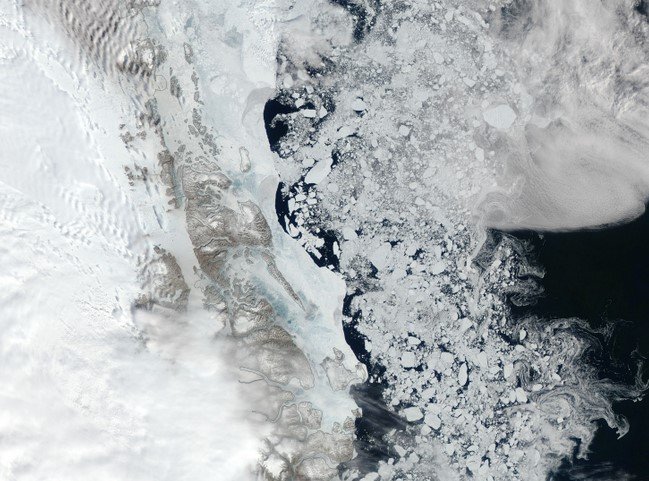
Sea ice floe remote sensing observations
Files contain a collection of geometrical and kinematic sea ice floe measurements to produce the analysis in the paper "Spinning sea ice floes reveal emerging mesoscale turbulence in the Arctic Ocean". The observations were retrieved from processed MODIS imagery as described in "Ice Floe Tracker: An algorithm to automatically retrieve Lagrangian trajectories via feature matching from moderate-resolution visual imagery".
-

Krill-inspired robotic platform
Files contain a collection of Computer-Aided Design (CAD) drawings of the parts needed to assemble the robotic appendage presented in the paper "RoboKrill : a metachronal drag-based swimmer robot." Kinematic curves for programming the assembly are included.
-

SOIT: Satellite Overpass Identification Tool
The Satellite Overpass Identification Tool (SOIT) is a Python-based program for identifying the daytime overpass time of the Aqua and Terra satellites closest to a point of interest for a given range of dates. Using Skyfield (an existing Python orbital mechanics package) and Space-Track.org (an online source of satellite data), the program determines the precise overpass times for Aqua and Terra. The algorithm can be easily modified to retrieve data for other satellites.
-
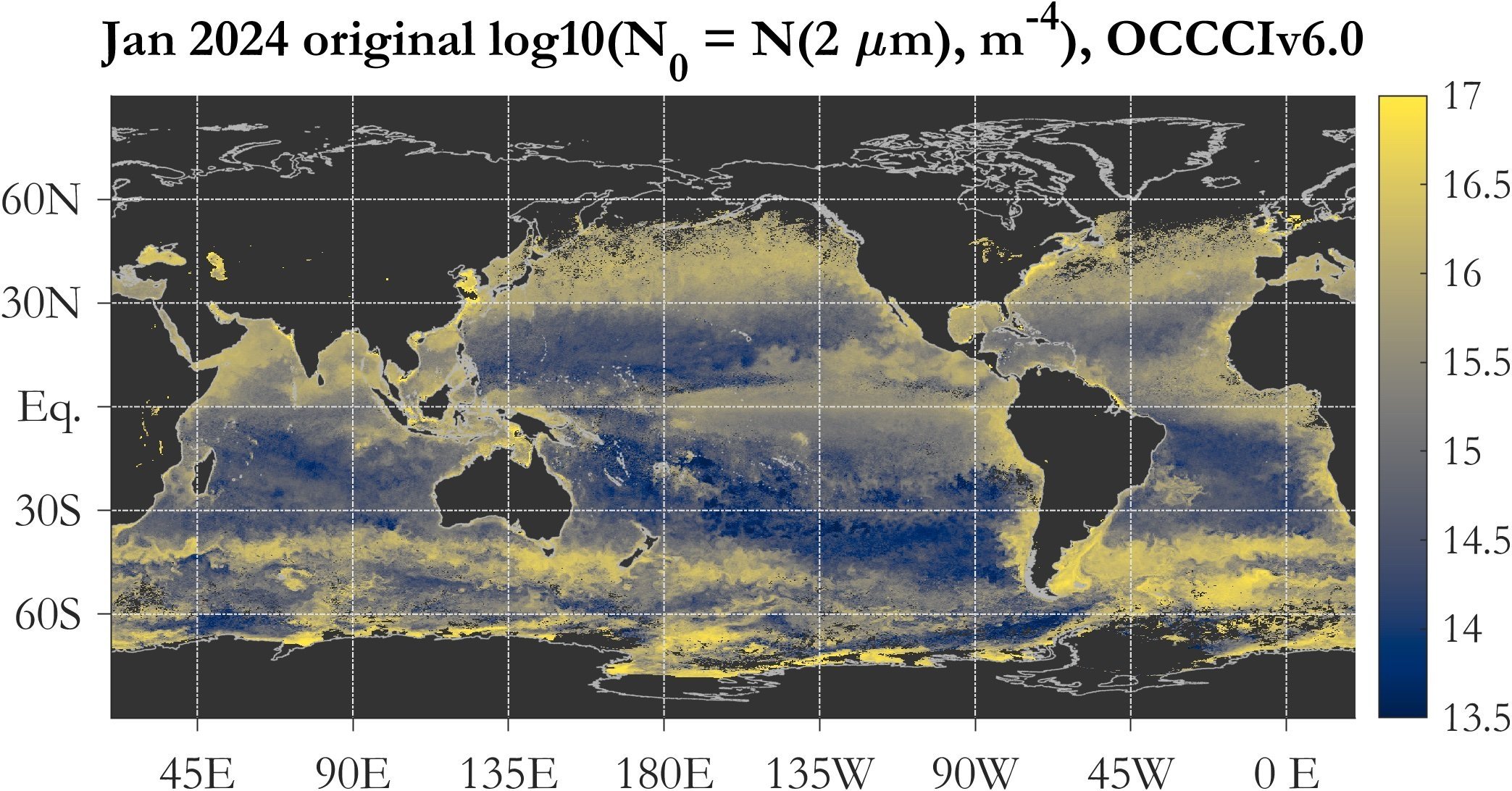
Mesozooplankton properties from passive ocean color observations
Monthly global merged passive ocean color satellite retrievals (spanning September 1997 to December 2024) of the following variables (at 0.25 degree spatial resolution): mesozooplankton numerical abundance, biomass, and diel vertical migration; particle size distribution power-law slope (not used in the derivation of the mesozooplankton data, included here for completeness), particle size distribution scaling factor N0 (differential numerical concentration at reference diameter of 2 micrometers) - original and tuned versions. For details on the PSD data retrieval algorithm and N0 tuning, see Kostadinov et al. (2023; https://doi.org/10.5194/os-19-703-2023) and associated manuscrupt assets (data set and scientific code linked therein).